TCAT to Trails map improves equitable access to nature
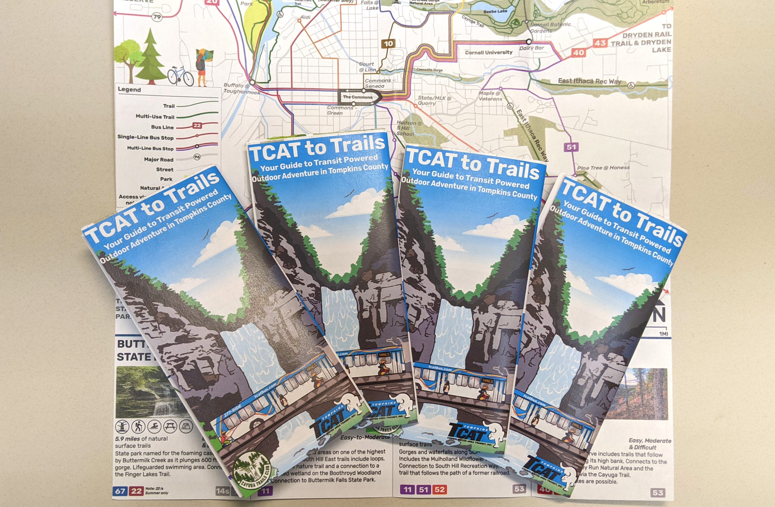
Last month, TCAT announced the release of its new TCAT to Trails map (tinyurl.com/yh7ymz4d), which details how to get to various natural areas and parks throughout the county from TCAT bus stops. The map is the result of a collective effort between Myra Shulman, a former Cornell University senior researcher, and several Cornell students, all with the aim of addressing equitable access to nature.
While at Cornell, much of Shulman’s research centered around ecology and marine biology, which is in line with her love of nature. She is also an avid hiker and a board member of the Finger Lakes Land Trust and the Cayuga Trails Club, which aims to “preserve nature and promote the joys of exploring the great outdoors,” according to a recent press release.
Last year, the Cayuga Trails Club decided to focus on fostering equity and eliminating barriers keeping county residents from accessing trails and parks throughout the area.
“We have about 235 members,” Shulman said. “And they don’t represent the diversity of Tompkins County. So, we started talking about why that might be and what we might be able to do to [increase] access to nature. … We were talking about other issues that might affect people’s access to nature, and transportation was an obvious one. … I was always driving to a trailhead. I didn’t really know how accessible trails and state parks and things were via TCAT.”
Shulman was already aware of ithacatrails.org, which outlines the natural areas and parks in the county as well as the parking areas for them, though not how to access them via public transportation.
“So, I had this lightbulb moment where I’m like, ‘Well, I know ithacatrails.org has a map of all the trails in the county, and obviously, there are bus maps that show all their routes and stops. All one should have to do is lay one of those over the other and see all the intersection points and create a map of bus places you can [get off to go on] hikes,’” she said. “How hard can this possibly be?”
As it turned out, it was a lot harder than Shulman initially thought. So, she brought in some help.
Shulman reached out to TCAT Assistant General Manager Matt Yarrow, who immediately jumped on board. Shulman’s efforts fell very much in line with the goals set out by TCAT’s new Transit Development Plan, so it was a no-brainer, as TCAT General Manager Scot Vanderpool described.
“One of our major goals here as an organization [is] to try to eliminate barriers for our residents, making sure that everyone has an opportunity to get to essential services, to employment, to youth centers and to recreation,” Vanderpool said. “We just so happen to serve, already, many of the trailheads, and I thought the map was a great idea to help people make those connections between TCAT and some of these potential outdoor possibilities.”
In addition to Yarrow, Shulman sent an email blast on the Cornell Outing Club listserv, to which a few Cornell students responded. They brought with them a wide range of experience both in nature and with TCAT, Shulman said.
“They were able to really speed up the process and make it much better, including creating a map for us to start putting all the bus stops on that connects with trails and with what trails they do connect to and what bus route access those bus stops,” she said.
After completing a thorough analysis of TCAT’s bus network and identifying what bus stops provided access to local parks and trails, the students surveyed 200 people to determine how they have and want to use TCAT to travel to those outdoor destinations, according to the press release.
Two of those students became the project managers for the map creation process: Quinn Kelly, who earned his master’s degree in regional planning from Cornell last May, and current Cornell junior Emile Bensedrine.
“I have a strong interest in transit, and also in equitable mobility and equitable access to outdoor recreation,” Kelly said. “And so, when I saw that email from her, I was immediately just really excited to be a part of that project. So, I immediately got back to her, and we started working on the research element of the project with a small team of students last fall, and then talked through different options for how to execute the broader project.”
Kelly then suggested Shulman reach out to Cornell Design Connect, a multidisciplinary, student-run, community design organization, bringing more students into the project.
Creating the map was a monthslong process, but everyone involved thoroughly enjoyed the work, as several members of the group told Tompkins Weekly. Bensedrine, for example, said he “absolutely loved” the experience.
“It was awesome,” he said. “Quinn was great because he was an amazing mentor on the project, having more experience, actually, in the planning world and everything. And then Myra was great in that she had this vision and this idea and these connections within the community that she really brought to the table and then also this huge knowledge of hiking in general in the area and the outdoors in the entire region.”
In addition to the map, the information Shulman’s crew provided informed TCAT where to improve signage for outdoor recreation as well as make other small tweaks with routing.
“One of the things that Design Connect and I did was to ask, ‘Where is it that the buses are currently not stopping that would provide good access to trails?’” Shulman said. “And I was floored, frankly, to discover how hard TCAT is willing to work to help make these connections. And I don’t know why I was floored; they are really, really interested in helping people access nature in addition to the things that they really have to think about, how to get people to their jobs, to shopping, back home, etc.”
Even though the map was finalized last month, everyone involved expects it to be a “living document,” allowing for adjustments as more bus stops get added in the future and other changes.
Vanderpool said he’d love the chance for Shulman to collaborate with TCAT again in the future, and Shulman said she’s planning to work with TCAT to create an “adventure guide” of sorts for area children to explore all that the county has to offer.
To view the map online, visit the previously listed website. Physical copies will be distributed to various TCAT bus stops in the coming weeks and are available at TCAT’s headquarters, 737 Willow Ave. in Ithaca. To learn more about TCAT, visit tcatbus.com.
Related Articles
Quantera’s new tech promises faster, safer chemical testing
Quantera Analytical is developing faster, safer chemical testing technology in Ithaca with roots at Cornell University.

“A Silent Force”: Gail Belokur brings creative leadership to the United Way
Gail Belokur, a Hometown Hero, brings compassionate and creative leadership to the United Way of Tompkins County.